Titanic Images - The Outlook Magazine
Outlook Magazine uses photographs relating to current events in their pictorial department and occasionally use pictures to illustrate articles, generally supplied by the author.
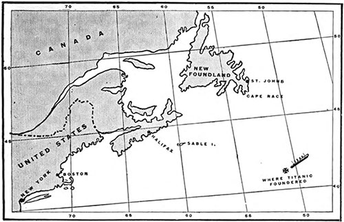
Map Marking the Location Where the RMS Titanic Foundered. The Titanic sank in 41.46 degrees N. latitude ; 50.14 degrees W. longitude. The distance from that point to Boston is 956 miles ; to Sandy Hook, New Jersey, the distance is 1.083 miles. From Halifax the distance to the spot is 610 miles, and to St. John's, Newfoundland, it is 362 miles. The Outlook (27 April 1912) p. 877. | GGA Image ID # 10e6d62af4
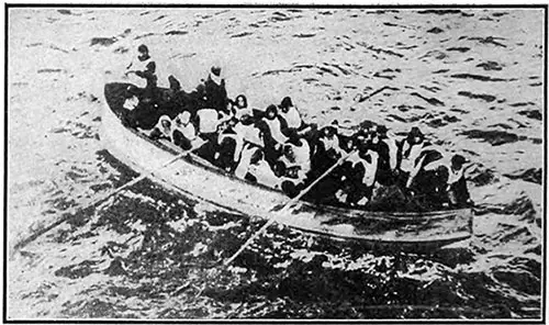
Titanic Survivors Photographed from the Carpathia. The Outlook (27 April 1912) p. 898. | GGA Image ID # 10e6d908cd
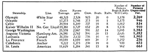
Table Showing Popular Passenger Steamships, Gross Tonnage, Passengers and Crew Capacity, Lifeboats and Rafts, Number of People Provided for and Number of People Not Provided For. There is practically not a transatlantic liner running out of New York Harbor that carries enough small boats to hold all of its passengers and crew. Many liners do not have enough lifeboat equipment for half of the ship's company legally allowed. Few have equipment sufficient to carry half of the passengers and crew. The Outlook (27 April 1912) p. 899. | GGA Image ID # 10e6ff2b3b
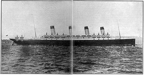
Where the RMS Titanic Could Have Carried Fifty Lifeboats. The arrows indicate the lifeboats of the Titanic, eight on a side, sixteen in all, exclusive of four collapsible canvas boats. The crosses show where extra lifeboats could have been placed, making fifty boats in all, twenty-five on a side. The Outlook (27 April 1912) p. 900-901. | GGA Image ID # 10e73b557e
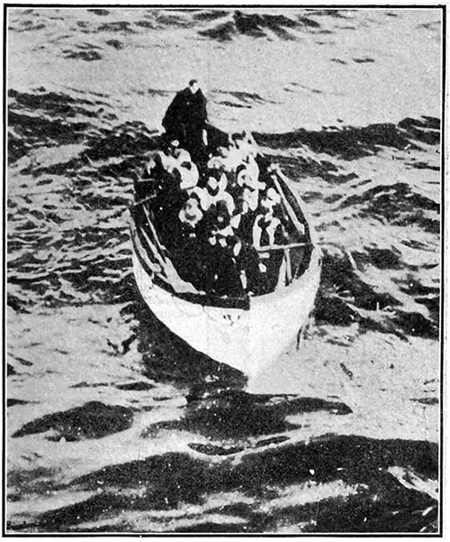
One of the Sixteen Lifeboats from the Titanic. The Outlook (27 April 1912) p. 903. | GGA Image ID # 10e73f80be
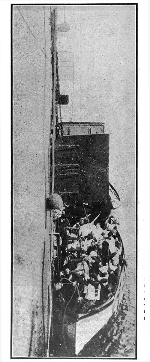
Survivors in One of the Lifeboats At the Side of the Carpathia. The Outlook (27 April 1912) p. 904. | GGA Image ID # 10e7a8f025
