
The National Army Cantonments - 1917
Brief descriptions of each National Army Cantonment include a history of the camp, information about the nearest town, climate, and how the camp was named.
The National Army Cantonments include Camp Devens, Camp Upton, Camp Dix, Camp Meade, Camp Lee, Camp Jackson, Camp Cordon, Camp Sherman, Camp Zachary Taylor, Camp Custer, Camp Grant, Camp Pike, Camp Dodge, Camp Funston, Camp Travis, and Camp Lewis.
Camp Devens
The cantonment at Ayer, Massachusetts, known as Camp Devens, houses the forces of the National Army drawn from New England. It lies to the north of the town of Ayer, on a site that was largely occupied by second-growth scrub timber. The ground is open and porous, as well as rolling, thus insuring good drainage The site was selected with an eye to having a force quartered near Boston, which is only 30 miles away, to defend that city in the event of any military emergency.
The town of Ayer has an unusual history's the history of New England towns goes. It is one of the most youthful of all the municipalities east of the Hudson River, having acquired a corporate existence and a name in 1871. The railroads of northern Massachusetts found convenient crossing points in that neighborhood. First there came a signal tower, then a village, and then a community, which tired of being called “The Junction” and wanted a real town name.
This camp has the lowest average temperature of any of the cantonments. On the other hand, it has more cloudlet days than any other with the single exception of Deming, New Mexico, which is in the “sunshine belt” of the South- west. Camp Devens' average temperature is 47 and it has an average of 200 cloudless days a year.
The smallest except one of the 16 cantonments, Camp Devens is larger than the neighboring cities of Taunton, Waltham, Quincy, and Pittsfield, being in a class with Fitchburg and Newton.
The men who get camp leave are in easy reach of many places famous in American history. Concord and Lexington, Cambridge and Charleston, and a hundred other places are there to stir men's souls to the spirit of the hour, and to enable officers to say in 1917 what Captain Davis said in 1775, in America's first battle for liberty against a German king: “I haven't a man that’s afraid to go.”
Camp Devens is named in honor of Brig. Gen. Charles Devens, a native of Massachusetts, whose distinguished services before Richmond in the Civil War brought him the brevet rank of major general. He was Attorney General of the United States under President Hayes.
Camp Upton
Camp Upton, which houses the National Army troops from the metropolitan district of New York City, is situated in the very heart of Long Island, about halfway between Brooklyn and Montauk Point and equidistant from the sound and sea. It is on the Long Island Railroad, between the villages of Yap- hank and Manorville. The region around the camp affords the usual Long Island scenery—a broad, open, level landscape, with many flourishing villages and well- kept country places.
Between New York and Camp Upton lies what has been pronounced the most intensely cultivated region in the United States. The soil is rather poor, but *he proximity of the greatest market in the country makes this region a medium par excellence for transforming sun and soil, fertilizer and water, into market vegetables.
At no point on Long Island is there an elevation of more than 391 feet and the temperature rarely falls below zero and seldom goes above 90, owing to the tempering influences of the sea. Snow usually lasts for a few days only, and the spring temperature is nearly always 5 degrees above that of the mainland. It ranks third among the cantonments and camps in the number of cloudless days, having an average of 188 a year.
Camp Upton is situated in a striking region. The whole island is founded on rock, although it outcrops only at Long Island City and Astoria. During the glacier age a vast sheet of ice from five to ten thousand feet in thickness flowed out from the region of the Great Lakes and shaved a pathway to the sea, in a southeasterly direction, overflowing the highest mountains of New York and New England, as is shown by the fact that to this day evidence of its eroding passage are to be found on the summits of these mountains.
Before this moving mass of ice all life disappeared. The glacier moved very slowly, perhaps not more than 100 feet a year, or a mile in 50 years. After a journey lasting 25,000 years, it reached the ocean and the vast wall of ice stretched across the Atlantic border from New Jersey to the Arctic Sea.
A huge mass of earth and rocky debris, known as the terminal moraine, piled up in front of the glacier. The ice melted and the debris, which had been scraped from the mountains, was dropped, a portion of it now forming the backbone of Long Island. Again the ice advanced, going just a little farther the second time, and the second range of hills was formed, extending from near Huntington to Montauk Point and Block Island, and including the region surrounding the site of Camp Upton.
Much of the debris of this second melting was in the form of a very thick mud, which flowed southward toward the sea and formed the present slightly sloping and very fertile plains of the island.
There are historical associations on Long Island as interesting as its geological history. At Easthampton stands the house in which the man who wrote the hymn common to the English-speaking world, “Home, Sweet Home,” was born— John Howard Payne. This cottage is a modest structure, standing on the main street near the center of the village.
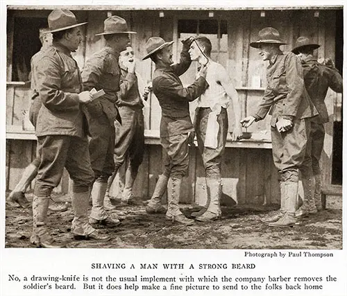
Shaving a Soldier with a Strong Beard. Photograph by Paul Thompson. No, a drawing-knife is not the usual implement with which the company barber removes the soldier’s beard. But it does help make a fine picture to send to the folks back home. National Geographic Magazine, November-December 1917. GGA Image ID # 17ddee1b1c
At Huntington, not many miles from Camp Upton, is a monument commemorating the unselfish devotion of Nathan Hale to his country when General Washington entrusted to him the task of ascertaining the movements of the enemy. After gathering the information he was betrayed and taken to New York and hanged.
His last words were: “I regret that I have but one life to lose for my country.” Many a Camp Upton soldier will journey hither and repeat those words in his heart as he dedicates his life to the duties of the present hour.
Camp Upton is named in honor of Col. Emery Upton, who was born at Batavia, N. Y., in 1839 and was graduated from West Point in 1861. He was three times wounded in the Civil War—at Bull Run, at Spottsylvania Courthouse, and at Opequan. For gallant conduct at Winchester under General Sherman, he was brevetted major general of volunteers.
After the Civil War he served as lieutenant colonel of the 25th Infantry, Regular Army, and later as colonel of the 4th Artillery. He prepared a system of tactics for the service, and from 1870 to 1875 was commandant of cadets at West Point. His writings pertaining to military preparedness are classics of their kind.
Camp Dix
Camp Dix, where the National Army from western New York, New Jersey, and Delaware is in training, is located near the town of Wrightstown, N. J., on the Delaware River side of the watershed that divides the State into east and west Jersey. The elevation above sea-level is approximately 100 feet.
One would have to travel far to find more beautiful fields or better-kept farms than those which had to be transformed into a training camp for the Jersey and neighboring troops.
Stretching across the State from the Atlantic Ocean below Sandy Hook to Salem, on the Delaware, and passing through Burlington County, in which Camp Dix is situated, is the marl region of New Jersey. The marl (an earthy, crumbling deposit consisting chiefly of clay, and greatly valued as a fertilizer) is found at various depths and sometimes lies in beds 30 feet or more thick. The ground above it is rich and highly productive.
When the construction forces started to work on the buildings for Camp Dix, they found themselves among great fields of growing corn and ripening wheat. Some of the farmers were very reluctant to move away from homesteads which had been in their families since the days before Washington crossed the Delaware; but the military authorities were patient with them and afforded them every consideration that the exigencies of the hour would permit.
It is told that one farmer took the money he received and made a long-deferred trip with his family to the West. When he came back the transformation was so marked that, although he and his father and his father's father had lived and worked upon his farm, he found difficulty in finding his way around.
While Camp Dix is situated in a rich agricultural community, it has the advantage of being contiguous to the pine-barren regions, where ideal grounds for target practice are available. Thousands of acres of these pine barrens have been cleared, so as to permit the training of men in the handling of big guns, as well as small arms.
Gen. John A. Dix, in honor of whom this camp was named, was an ensign in the War of 1812 at the age of 14 and lived to become major general of volunteers in the Civil War. As the President of the Union Defense Committee during the latter conflict, he organized 17 regiments and was instrumental in saving Maryland for the Union.
At the outbreak of hostilities he was Secretary of the Treasury. Two revenue cutters were ordered home from New Orleans by him. One of the commanders refused to obey. He was ordered placed under arrest, and Secretary Dix telegraphed the now famous command, “If anyone attempts to haul down the American flag, shoot him on the spot.”
Camp Meade
Camp Meade was built for the National Army forces drafted from eastern Pennsylvania, Maryland, and the District of Columbia. It has a housing capacity greater than that of any city in Maryland except Baltimore. Indeed, its population is twice as large as that of the State's second city—Cumberland.
Situated midway between Washington and Baltimore, the climatic conditions are largely the same as those prevailing at Camp Dix, New Jersey. The average annual temperature is 58, and there are 131 days of cloudless weather a year, with 124 days partly cloudy.
The region around Camp Meade is a quiet, pastoral community, but when the men secure camp leave, they are only an hour's ride from Baltimore or Washington. Only a little more than 20 miles away is Annapolis, capital of the State and dear to the heart of every American as the home of the U. S. Naval Academy, where such defenders of the Nation's flag as Farragut, Dewey, Sampson, and Evans were graduated. Within 50 miles as the crow flies are Gettysburg and Antietam, two of America's greatest Battlefields.
Camp Meade was named in honor of Maj. Gen. George Gordon Meade, the commander of the Union forces at the battle of Gettysburg, where the tide was finally turned against the Southern Confederacy by the defeat of Gen. Robert E. Lee's forces and the shattering of Southern hopes of success on Northern soil.
General Meade was born in Cadiz, Spain, of American parentage, the year that Napoleon was defeated at Waterloo. After the war citizens of Philadelphia presented him with a house, and after his death, in 1872, a fund of $100,000 was raised and presented to his family as a testimonial to his services in saving the Union.
Camp Lee
Situated three miles due east of Petersburg, on the electric railroad to Hope- well, the magic munition city, and on the Norfolk & Western Railroad's main line to Norfolk, Camp Lee. housing most of the troops of western Pennsylvania and all of those from Virginia and West Virginia, is, with the single exception of Camp Lewis, the largest of all the National Army cantonments.
It accommodates 46,400 men, which makes it the third municipality in point of size in the Old Dominion. Only Richmond, the capital, and Norfolk, the chief seaport, are larger. It is twice the size of Newport News, which is doing so much in forging America’s answer to submarine losses.
The climate is fairly equable, the average annual temperature being 58 degrees, as compared with 47 at Camp Devens, 51 at Camp Upton, and 54 at Camp Dix. About 139 days of the year are clear and 118 partly cloudy.
The geography of the Petersburg region made it important in the history of the nation. Situated on the Appomattox River, 20 miles from its confluence with the James, it is the converging point of all the main highways and railroads from the south, the southeast, and the west. Its strategic value gave it a role in Revolutionary operations and made it in many ways the key to the Confederacy.
The region in which Camp Lee is located is richly historic. Twenty miles north is Richmond, capital of the Confederacy. Less than forty miles away, is Jamestown Island, scene of the first permanent English settlement in America. A few miles farther will bring the pilgrim to Williamsburg, where met the first elected legislative body in America.
Fifty miles to the east is Yorktown, where the French threw the weight of their arms heavily in the balance and helped America achieve her independence. Only 60 miles away is Newport News, with its big embarkation camp from which the men who are now training will sail for France and the fighting front.
Camp Lee was named for General Robert E. Lee, the brilliant chieftain of the Southern Confederacy, who, born in 1807, the son of “Light Horse Harry” Lee of the Revolutionary Army, lived to become universally acknowledged one of the great captains of military history.
Camp Jackson
Located in the heart of South Carolina, with its southwestern corner only four miles from Columbia, the State capital,
Camp Jackson, where the National Army troops from the two Carolinas will train, has a mild climate, with an average temperature of 63.
The weather conditions are similar to those on that part of the French front where it is expected American troops will be sent. The camp site is drained by Gill Creek, and Wildcat Road had to be closed for more than two miles to permit the building of the cantonment.
Camp Jackson is within 100 miles of the National Guard Mobilization Camps at Charlotte, N. C., Spartanburg, S. C, Greenville, S. C, and Augusta. Ga.
Columbia is South Carolina’s railroad as well as geographic and political center. It is located on the east bank of the Congaree River, at the head of navigation, and is on the dividing line between what is known as the red and sand hills region and the piedmont district. It is in a section noted for its sanitariums and winter resorts.
Camp Jackson is named in honor of Andrew Jackson, seventh President of the United States. North and South Carolina both claim to be the State 0i his birth. North Carolina says he was born in the Waxhaw settlement, in Union County, N. C, while South Carolinians claim that distinction for a spot near Waxhaw Creek, in Lancaster County. S. C. Jackson always gave the latter as his birthplace, and his most thorough biographer thinks that the weight of evidence favors his South Carolina origin.
His father died in Union County a few days before his birth, and his mother went to live with her sister in Lancaster County. The controversy hangs on the issue of whether he was born before or after the mother went to her sister’s home.
Camp Cordon
Camp Gordon, where the National Army forces from Georgia, Tennessee, and southeastern Alabama are being trained, is situated 9'/z miles north of the heart of Atlanta, Ga., on the main line of the Southern Railway from Washington. In the extreme northwest part of the camp is Silver Lake, one of the most beautiful bodies of water in the South. At the gate of Camp Gordon are Oglethorpe University and Humphries Park.
The capacity of this cantonment is 40,156. It disputes with Macon and Augusta for the honor of being the third city in Georgia. The soldiers quartered there will have very few winter rigors to undergo. While the mercury in the thermometer has occasionally fallen below the zero point, a really cold day is rare, and the average temperature for the year is 61 degrees Fahrenheit. Only 106 days in the year are sunless, while 111 of the sunny ones have no clouds on the horizon.
Atlanta, host to the Camp Gordon forces, is a young city. Accustomed to municipal history, which is nearly always rooted in the colonial era, it seems strange for Easterners to think of Atlanta having no place on the map until its first inhabitant settled there in 1839. The village was originally called Terminus. from the fact that it was at the end of the Georgia Railroad, but in 1843 it was incorporated under the name of Marthasville, a designation it forsook in 1845, in favor of Atlanta.
At the outbreak of the Civil War the erstwhile railhead settlement had a population of 15.000 and became a strategic point during that conflict. In 1864 it was the objective of General Sherman’s offensive from Chattanooga. Capturing the city on September 2, he began his march to the sea on November 15th.
Camp Gordon was named for General John B. Gordon, one of the ablest officers of the Confederacy. His grandfather was one of seven brothers, all of whom fought in the Revolutionary War. When the Civil War began, he was engaged in mining work in Alabama and was without military training.
Organizing a company which called itself the “Raccoon Roughs,” he became its captain, and rose through successive grades to a major generalship. He was made a brigadier for his distinguished conduct at Malvern Hill, Seven Pines, and Sharpsburg. He held the “farthest cast" record of the Confederate forces, having, before the battle of Gettysburg, penetrated as far as Wrightsville, on the Susquehanna. After the war he was elected Governor of Georgia and. also served in the U. S. Senate.
Camp Sherman
Camp Sherman, built to shelter the National Army forces mustered into the Federal service from Ohio and a small section of western Pennsylvania, is located at Chillicothe, Ohio. Chillicothe is one of the big cross-roads of the State of Ohio. The Norfolk & Western and the Baltimore & Ohio main lines from Columbus to Norfolk and from St. Louis to Philadelphia, respectively, cross here. The Ohio & Erie Canal, which connects the waters of the Great Lakes with those of the Ohio River, passes by the city.
The camp is situated about three miles northwest of Chillicothe, in one of the finest farming belts of the Buckeye State. The 1,900-acre site is practically level, there being no more than 25 feet difference between the elevation of any two points in the whole area. The site parallels the Scioto River at a distance of about half a mile from its bank. The camp headquarters is located in an old southern Ohio mansion which stands in the big parade ground.
In the average year Chillicothe has 130 days in which the clouds hide the sun all day. There are about 100 days of sunshine and 135 partly cloudy. The average temperature is higher than that of most northern cantonments, being 53 degrees.
Camp Sherman was named in honor of General William Tecumseh Sherman, the hero of Chattanooga. His father died when he was nine years of age, and he was reared in the family of Thomas Ewing, whose daughter he married in later years. In 1856 he predicted the Civil War, saying that “unless people both North and South learn more moderation, we will sec sights in the way of civil war.”
Resigning the superintendence of a military school in Louisiana when that State seceded, he returned to his home in the North and volunteered for service. By successive steps he rose from colonel to be a major general of volunteers. Later he was made a brigadier general in the Regular Army and given command of the Western forces by General Grant when the latter became Commander-in- chief.
After the fall of Chattanooga he invaded Georgia. Capturing Atlanta, he issued orders for all of its people to leave. The civil officials protested, which led to the oft repeated saying ascribed to him, “War is hell.” What he actually said was “You cannot qualify war in harsher terms than I will; war is cruelty, and you cannot refine it.”
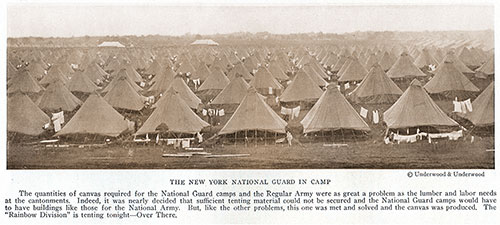
The New York National Guard Soldiers in Camp. Underwood & Underwood. The quantities of canvas required for the National Guard camps and the Regular Army were as great a problem as the lumber and labor needs at the cantonments. Indeed, it was nearly decided that sufficient tenting material could not be secured, and the National Guard camps would have to have buildings like those for the National Army. But, like the other problems, this one was met and solved, and the canvas was produced. The “Rainbow Division” is tenting tonight—Over There. National Geographic Magazine, November-December 1917. | GGA Image ID # 17de360e5d
Camp Zachary Taylor
Camp Taylor located beyond the city limits of Louisville, Ky., is the training camp for the divisions of the National Army which will come out of Kentucky, Indiana, and southern Illinois. No pan of the camp is more than seven miles from the heart of the city, all of it except the maneuver grounds, indeed, lying close to the five-mile line from the center of the town. Its sewerage and water systems connect with those of Louisville and it gets its electric light from there.
None of the camps has been laid out with more attention to ideals of city planning than Camp Taylor. 'There are some beautiful groves of trees and commanding knolls attract the eye. The average temperature at Camp Taylor is 57, with 107 as the highest summer heat on record and 21 below zero as the lowest winter cold. It has an average of 107 days of full sunshine and 118 o' unbroken cloudiness 2 year.
Louisville illustrates the effect of geography on history. It is situated at the falls of the Ohio Rivet In the year 1778 Genera George Rogers Clark was floating down the Ohio, his boats loaded with soldiers for the conquest of the Illinois country. When he came to the falls, he concluded that what was afterward known as Corn Island, but which has since been washed away, would be an ideal cantonment site for the training of his raw recruits, since it was safe from Indian raids and desertion would be difficult.
He brought some twenty emigrant families with him and built log cabins for them. After training his men he resumed his voyage down the river, leaving the emigrant families behind. They finally moved off the island and settled in a bend of the river on the Kentucky side and there founded the city of Louisville.
Fifty miles away is Hodgenville, where Abraham Lincoln was horn. Within three hours' ride is Mammoth Cave, the world’s greatest caverns, which served America in her first war for liberty as the mines of Minnesota are serving her now, furnishing the saltpeter then unobtainable elsewhere, even as Minnesota furnishes the iron ore today.
Camp Taylor was named for Zachary Taylor, twelfth President of the United States and hero of Buena Vista, where he won a notable victory over Santa Anna, the Mexican leader, in 1847.
Camp Custer
Situated in the environs of Battle Creek, famous for its breakfast foods and rest cures, Camp Custer, which is given over to the National Army forces from Michigan and eastern Wisconsin, is the smallest of the 16 cantonments. The Kalamazoo River runs past the camp site, and the barracks are ranged along the crest of a hill, shaped like a boomerang. At the end of the parade ground there is a beautiful flower garden, planted by the ladies of Battle Creek.
Although the camp is the smallest of the cantonments, it is a sizable place. Eleven hundred buildings, a half-million- dollar hospital, 20 miles of sewerage, 16 miles of water pipe, 8 artesian wells, with a combined flow of 4,000 gallons a minute, are not mean figures. The hospital, with its 59 buildings, is laid out around Eagle Lake, a beautiful sheet of water.
Some fifty miles from the shores of Lake Michigan, a hundred miles from Lake Erie, and about forty from the Indiana State line, Battle Creek has an ideal location as a mobilization center.
Battle Creek was not on the map before 1850, being incorporated as a village in that year; but as a junction point of the main lines of the Grand Trunk and the Michigan Central railroads, it soon began to flourish.
Camp Custer was named for General George A. Custer, who was killed in a battle with Sitting Bull and Crazy Horse, June 25, 1876.
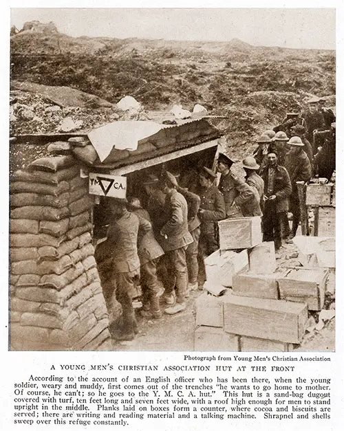
A Young Men’s Christian Association Hut at the Front. Photograph from Young Men’s Christian Association. According to the account of an English officer who has been there, when the young soldier, weary and muddy, first comes out of the trenches “he wants to go home to mother. Of course, he can’t; so he goes to the YMCA hut.” This hut is a sand-bag dugout covered with turf, ten feet long and seven feet wide, with a roof high enough for men to stand upright in the middle. Planks laid on boxes form a counter, where cocoa and biscuits are served; there are writing and reading material and a talking machine. Shrapnel and shells sweep over this refuge constantly. National Geographic Magazine, November-December 1917. | GGA Image ID # 17de4e6bc2
Camp Grant
Located about five miles south of Rockford. III., to the east of Rock River, and connected with that city by a magnificent
concrete highway, Camp Grant, which is the training quarters for the men who will constitute the divisions to be drawn from northern Illinois and all except the Lake Michigan shore counties of Wisconsin, is one of the most northerly of the 16 cantonments. It has more sunny days than any other of the 16 cantonments, with 274 cloudless or only partially cloudy ones annually.
Camp Grant is bounded on the west by the Rock River and fronts the north bank of the beautiful little Kishwaukee River for a distance of half a mile. Rockford, with a population of 60,000, was so enthusiastic about having a cantonment near it that a fund of $100,000 was raised to improve conditions there. The Chamber of Commerce built some 400 residences on a tract outside of the cantonment to be used as homes for the officers. No city has shown a heartier hospitality to the new National Army forces than Rockford.
This cantonment was laid out with an eye to preserving the natural beauty of the site. A magnificent fringe of trees stretches along the banks of Rock River and has been preserved for park purposes. Some rare old farmhouses have been utilized as officers’ quarters.
A circle drawn around the camp at a distance of 80 miles will pass through Chicago and Milwaukee, cross the Mississippi at Dubuque and embrace an area in Iowa within the Big Bend of that river between Dubuque and Davenport. This territory embraces magnificent farming land, and the great dairy region of which Elgin is the center, and from which annually come hundreds of millions of pounds of golden butter.
Of course, everybody knows for whom this camp was named—Gen. Ulysses S. Grant, chief military hero of the Northern armies in the Civil War and afterward President of the United States.
Camp Pike
Camp Pike situated eight miles northwest of Little Rock, Ark., houses the National Army forces drawn from Arkansas, Louisiana, Mississippi, and western Alabama. Here an up-to-date military city of 42,000 capacity had virtually to be built in the midst of a wilderness. Ground was broken for the camp on July 9th.
The site was almost entirely covered with second-growth timber, the nearest railroad was five miles away, and supplies had to be brought by truck from Little Rock over hilly highways. A vast deal of rock was encountered in ditching tor water and sewer pipes—nearly 75 per cent of the total excavations, in fact.
Labor was scarce, as Camp Funston, in Kansas, had an earlier start and had secured most of the available supply. But the contractors ranged far and wide, even into the Mexican States of Chihuahua and San Luis Potosi, with the result that all handicaps were overcome. This camp has little level ground, resembling Camp Ayer and Camp Gordon in that respect, and many heavy grades in the road system result. The 75 hospital buildings cover 47 acres of ground.
Little Rock, which plays the role of host to Camp Pike, is the largest city in Arkansas. It was settled in 1814, becoming the scat of the territorial government in 1820, although at that time it had a population of only 20 people.
Situated on both banks of the Arkansas River, the city takes its name from the rocky promontory which rises to a height of some 50 feet above the river. It was called Little Rock in contradistinction to the bold precipice, some 3 miles above and about 500 feet high, which was known as Big Rock.
To the west of the city and of Camp Pike the foothills of the Ozark Mountains rise, but to the east are fertile cotton fields and corn lands. The Arkansas River is navigable to boats of considerable draft as far as Little Rock, while steamboats of shallow draft go as far as Fort Smith, 165 miles to the west.
At the outbreak of the Civil War the State was hopelessly divided in sentiment. The upland people, living west of Little Rock, were Unionists and the cotton-territory folk, living east, were Secessionists. Camp Pike stands near the line of cleavage.
Camp Pike is named in honor of General Zebulon M. Pike, an American soldier and geographer. Born in lumber- ton, N. J., in 1779, he spent his boyhood in Pennsylvania, and in 1805 started from St. Louis on an expedition to locate the source of the Mississippi. He was successful. Later he followed the Missouri and Osage rivers into Kansas, then went southward to the Arkansas, proceeding through Kansas and Colorado to the present site of Pueblo, and viewed Pikes Peak (since named in his honor). While searching for the Red River he lost his way and wandered into Mexican territory across the upper Rio Grande.
He was arrested, taken to Chihuahua, and, after some delay, escorted back to the border. In the War of 1812 he led American forces into Canada and was killed at York by falling rock when the retreating force blew up a powder magazine. He died while his nomination for brigadier general was pending.
Camp Dodge
Troops from four States are being trained at Camp Dodge, 11 miles north of Des Moines, Iowa. These troops include all of the National Army forces from Iowa, North Dakota, and Minnesota, and those from a middle belt of Illinois.
Military scenes are not new to the neighborhood of Camp Dodge, for the site embraces the Fort Dodge State rifle range and maneuver grounds of the Iowa National Guard in peace times.
The camp lies on both sides of the Des Moines River and occupies an area of about 3,500 acres. Many other cities sought the cantonment, but Des Moines showed that it enjoyed 3,000 hours more of sunshine a year than any rival site. It has 259 days of all or part sunshine. Its average annual temperature is 48 degrees.
Des Moines is one of the great railroad centers of the Middle West. It is the capital of the State, and its name signifies “Of the Monks.” Founded 71 years ago, it is now a city of 100,000 progressive citizens.
Camp Dodge was named for General Grenville M. Dodge, a civil engineer who helped to make the Platte Survey, one of the first railroad surveys toward the Pacific. He was an officer in the Civil War rising to the rank of major general of volunteers.
In 1864 he commanded the Sixteenth Corps of General Sherman's army in the campaign which resulted in the fall of Atlanta. Later he was given command of the Department of the Missouri.
He became chief engineer of the Union Pacific in 1867, and of the Texas and Pacific in 1871. He served a term in Congress, and in 1898 was appointed by President McKinley as chairman of a commission to investigate the charges of departmental mismanagement in the Spanish-American War.
Camp Funston
It devolves on Camp Funston, located at Fort Riley, Kansas, which stands at the confluence of the Republican and the Kansas rivers, to accommodate the National Army forces from seven States— Missouri. South Dakota, Nebraska, Kansas. Colorado, New Mexico, and Arizona.
The men who will train at this camp may well feel that they are closer to the heart of the United States than any of the other military forces of the nation, for at Fort Riley stands the Ogden Monument, proclaiming the exact geographic center of the United States.
The military reservation on which Fort Riley stands, and on which Camp Funston was built, embraces nearly 20.000 acres. A military road connects Fort Riley with Fort Leavenworth, on the Missouri River, about 25 miles above Kansas City. This road was completed in 1854. Later it was extended westward to Bridgers Pass, between Nebraska and Utah. Fort Riley is the seat of the United States Cavalry and Field Artillery schools, which accounts for the big area embraced in the reservation.
Camp Funston can accommodate 41,000 people—a city as populous as the State capital. To the south of the camp runs the Kansas River and to the north are grass-covered hills. It would be difficult to imagine a more striking location for a camp.
The fertile valley of Kansas' middle river sweeps eastward, and one gets the feeling of the boundless reaches of America as he surveys the scene from the green hills to the north. The county adjoining Riley on the east is Pottawatomie, home of John Brown. Sixty miles to the southeast is Emporia, where "What's the Matter with Kansas" had its birth.
Camp Funston is named for Genera! Frederick Funston, who died only a few months ago at San Antonio, Texas. Rom at New Carlisle, Clark County, Ohio, m 1865, the son of an artillery officer in the Civil War, his boyhood was spent on the Kansas farm.
He was educated at the State university, became a reporter and then a special agent of the United States Department of Agriculture, where his work took him across Death Valley, into the heart of Alaska, down the Yukon alone in a canoe and up the 141st meridian to the Arctic Ocean.
Later he traveled in Mexico, then went to Cuba, where he joined the cause of Cuba as a captain of artillery. While campaigning with Gomez and Garcia he was wounded, and, seeking to return to the United States, was captured by the Spaniards who condemned him to be shot. Upon being released he returned to the United States.
At the outbreak of the Spanish American War he raised the 20th Kansas Volunteer Infantry Regiment. He was sent to the Philippines, where, on a small raft, he crossed a river under heavy lire and established a rope ferry that enabled the Federal forces to win an important victory at Calumpit.
For this act of bravery he was awarded the Congressional Medal of Honor, and later organized the expedition that captured Aguinaldo. His more recent services especially as commander of the American forces on the Rio Grande and as tin- head of the expedition to Vera Cruz, are well known.
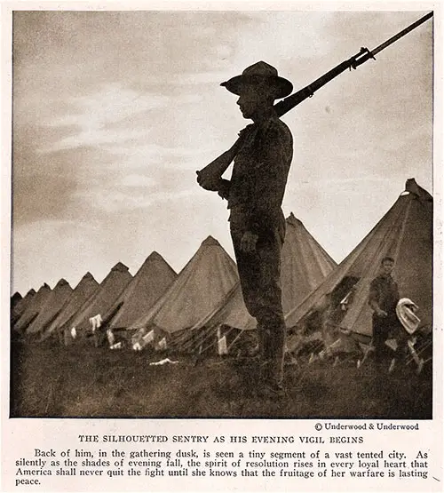
The Silhouetted Sentry as His Evening Vigil Begins. Back of Him, in the Gathering Dusk, Is Seen a Tiny Segment of a Vast Tented City. As Silently as the Shades of Evening Fall, the Spirit of Resolution Rises in Every Loyal Heart That America Shall Never Quit the Light Until She Knows That the Fruitage of Her Warfare Is Lasting Peace. Photograph © Underwood & Underwood. National Geographic Magazine, November-December 1917. | GGA Image ID # 17de73d950
Camp Travis
San Antonio has the unusual honor of having four military camps—Camp Travis, housing the National Army contingent from Oklahoma and Texas: Camp Wilson, housing contingents of Regular Army forces on the Mexican border. Fort Sam Houston, a Regular Army post; and Camp Kelly, an aviation camp.
The city’s popularity with the army is deserved, as it has seasonable weather for military training every month in the year Its average temperature is 68° and its lowest is 40 above zero. Furthermore, it occupies a strategical position with reference to 2.000 miles of turbulent and somewhat unfriendly border. Camp Travis lies immediately to the east of Camp Wilson, along the Austin road. It adjoins Fort Sam Houston, which is second in importance among the military reservations in the United States.
The men at Camp Travis are training on historic soil. The city is the largest in the Lone Star State, situated about 140 miles inland from the Gulf of Mexico, at Rockport, and the same distance from the border city of Laredo, on the Rio Grande. The railroads centering there lead south to Laredo, southeast to the Gulf, west to Eagle Pass and El Paso, and northeast to the principal cities of the Mississippi Valley.
The city is a quaint combination of old Spanish and modern American architecture. It is beautifully laid out on a plateau over 600 feet above sea-level, a few miles below the wonderful chain of crystal springs from which the San Antonio River flows.
Seventeen iron bridges span the river, which meanders for 13 miles through the city. The public plazas, with their subtropical trees, their chile con carne and hot tamale stands, and their debouching streets with liquid Castilian names, make one think of Monterey and Chihuahua, which were, before the passing of the Diaz régime, about as much American as San Antonio is Spanish.
The city was born of the fierce rivalry between France and Spain for the possession of the rolling prairies of Texas. Both sent expeditions of exploration to this region. The Spaniards established missions and held the territory.
When Texas revolted against Santa Anna, in 1835, the city was taken by the Texans, whose garrison included William B. Travis and “Davy" Crockett.
The city fell and Travis and his command, numbering 179, fortified themselves in the Alamo, with their rifles and 14 cannons. The siege lasted 10 days, with 6,000 troops against the devoted 179.
When the place was finally captured every defender left alive was butchered, but they had accounted for a casualty list of i,6co among the Mexicans. In 1842 the Spaniards took the city a second time and marched off its most prominent citizens to dungeons in Perrotte Castle, State of Vera Cruz.
A few days later it was retaken by Hays and Caldwell, never to fall into Mexican hands again.
Col. William B. Travis, for whom Camp Travis is named, was born in Edgefield County, South Carolina, in 1811. He studied law, moved to Alabama, then to Texas. He became a colonel in the Texas army in 1832, was captured by the Mexicans, and released.
How gallantly Colonel Travis, at the age of 25 years, conducted his defense of the Alamo is a story which has fired the imagination of American schoolboys for three-quarters of a century.
Camp Lewis
The biggest cantonment, both in capacity and in the number of States whose troops it will house, is Camp Lewis, i/l/2 miles south of Tacoma, Washington, at Dupont, on the Northern Pacific Railway, and on the splendid Pacific highway. It has quarters for 47,650 officers and men and stables for 15.000 horses. It will be the training school of all the National Army forces drawn from the eight States of Montana, Wyoming, Idaho, Washington, Oregon, California, Nevada, and Utah.
This site has long been regarded as the finest military training ground west of the Rocky Mountains. It has more entirely clouded days than any other cantonment site, yet it enjoys the most equable climate of the 16. Even Camp Travis, in a latitude 1,200 miles farther south, sometimes shows a winter thermometer only 4 degrees above zero, while the low mercury mark for Camp Lewis is 9 degrees above. The warm winds of the Japan current make the climate of this region so equable that Washington has been given the sobriquet of the Evergreen State.
Within a few miles of the camp site every kind of obstacle that nature opposes to soldiers may be found. The low ranges of the Cascades are hard by; Mt. Rainier is not far away. The soldiers, therefore, may practice on any kind of terrain, from Alpine heights to level savannas.
Camp Lewis is situated in the great Puget Sound Basin, between the coast and Cascade ranges of mountains. In its highest parts this basin scarcely rises more than 500 feet above sea-level, and for more than half of its length is penetrated by the southern arms of Puget Sound—a body of water which forms one of the finest systems of harbors in the world.
Camp Lewis was named for Captain Meriwether Lewis, one of the leaders of the famous Lewis and Clark Expedition, through which the American people gained their first knowledge of the great Northwest. Lewis was born near Charlottesville, Va., in 1774. He enlisted in the forces sent to put down the Whiskey Rebellion in 1794, entered the Regular Army as a lieutenant in 1795, became a captain in 1797, and Thomas Jefferson’s private secretary in 1801.
While President, Jefferson sent a confidential message to Congress asking an appropriation for an expedition to plant the American flag on the territory from the Mississippi to Puget Sound. After the appropriation was in hand, he appointed Captain Lewis and Captain Clark to lead the expedition.
They started up the Missouri in the spring of 1804, following that river to its source, and then struck down the Columbia River to the Pacific. They returned by the same general route, exploring many adjacent valleys on the way. Captain Lewis was afterward appointed Governor of the Territory of Louisiana.
William Joseph Showalter, "America's New Soldier Cities: The Geographical and Historical Environment of the National Army Cantonments and National Guard Camps," in The National Geographic Magazine, Washington, DC: National Geographic Society, Vol. XXXII, Nos. 5 and 6, November-December 1917, pp. 446-467.