Cunard Line Handbook - 1905
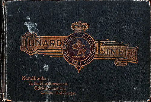
Front Cover, Cunard Line Handbook To The Mediterranean, Adriatic and the Continent of Europe. Published by Turner and Dunnett, Liverpool, 1905. GGA Image ID # 1fbd40dce7
From the Introduction
The information in the following pages has been prepared for the use of Passengers traveling by the Cunard Hungarian-American Line from New York to the Mediterranean and Adriatic. Original grey cloth hardcover book with Cunard logo and design on front cover. The book is illustrated with 17 tipped-in folding maps., numerous drawings, and many photographs of the Cunard passenger fleet.
Contents
Index
INTRODUCTION
PART I.— The Ports of Call and the Places of Interest in the Neighborhood
Gibraltar and Neighborhood:
- Gibraltar
- Andalucía and the Cities of Southern Spain
- Algeciras
- Ronda
- Granada
- Cordova
- Seville
Places on the Coast of North Africa, Which May Easily Be Visited From Gibraltar—
- Tangier
- Tetuan
- Algiers
Other Cities of Spain Accessible From Gibraltar—
- Cadiz
- Madrid
- Malaga
- Toledo
- Routes from Gibraltar across the Continent to Liverpool
II. —Naples, Palermo, Italy And Sicily:
- Naples
Places of Interest in the Immediate Vicinity of Naples—
- Castell Amare
- Sorrento
- Capri
- Palermo
- Sicily
- Catania
- Messina
- Syracuse
Famous Italian Cities Easily Accessible From Naples—
- Rome
- Florence
- Pisa
- Genoa
Other Italian Cities and the Italian Lakes—
- Ancona
- Bologna
- Leghorn
- Lucca
- Milan
- Perugia
- Ravenna
- Salerno
- Sienna
- Turin
- Venice
- Verona
The Italian Lakes—How a Tour may be made
- Como
- Garda
- Iseo
- Lugano
- Maggiore
- Orta
- Varese
- Routes from Naples Across The Continent to Liverpool
III. —The Sea-Route From Naples To Trieste
IV. —Trieste and Austria—
- Trieste
- Vienna
- Marienbad and Carlsbad
- Innsbruck
- Ischl
- Prague
- Routes from Trieste Across The Continent to Liverpool
V. —Fiume, Hungary, Etc.—
- Fiume
- Abbazia
- Budapest
- Dalmatian Archipelago
- Zara Spalatro
- Ragusa Cattaro
- Lissa
- Routes from Fiume across the Continent to Liverpool
PART II.—Countries that may be passed through on the way to Liverpool Overland from the Ports Of Call
- Baden-Baden Berlin Bonn
- Coblentz Cologne Dresden
- Dusseldorf
I.—Germany And The Rhine—
- Ems
- Frankfort
- Freiburg Leipsic
- Mayence Munich
- Strassburg
- Wiesbaden
II.—Switzerland—
- Basle
- Berne
- Chamounix
- Geneva ..
- Lake of Interlaken
- Lausanne
- Lucerne ..
- Lake of Neuchatel
- Zurich
- Lake Zug, Lake of
III. France And The Riviera
- Aix-Les-Bains Arcachon
- Biarritz Bordighera
- Cannes Hyeres Lyons
- Marseilles Mentone
- Monte Carlo Nice Paris
- San Remo
IV.—Holland and Belgium—
- Amsterdam
- Antwerp
- Bruges
- Brussels ..
- Ghent
- Haarlem
- Leyden
- Scheveningen
- The Hague
- Offices of the Cunard S. S. Co, Ltd.
- Principal Passenger Agents (Continental)
- General Passenger Agents
INDEX OF PLANS AND MAPS
- Map shewing Overland Rail Connection to Liverpool from Mediterranean Ports.
- Gibraltar from Mediterranean Ports
- Naples from Mediterranean Ports
- Italy and the Adriatic from Mediterranean Ports
- Palermo from Mediterranean Ports
- Sicily from Mediterranean Ports
- Rome from Mediterranean Ports
- Florence from Mediterranean Ports
- Genoa from Mediterranean Ports
- Turin from Mediterranean Ports
- Venice from Mediterranean Ports
- Trieste from Mediterranean Ports
- Vienna from Mediterranean Ports
- Fiume from Mediterranean Ports
- Budapest from Mediterranean Ports
- The Rhine from Mediterranean Ports
- Switzerland and the Italian Lakes from Mediterranean Ports
- Holland and Belgium from Mediterranean Ports
STEAMER PICTURES
- Carpathia
- Slavonia
- Pannonia
- Campania and Lucania
- Caronia and Carmania
- Umbria and Etruria
- Ivernia and Saxonia
Other Information Included in the Book
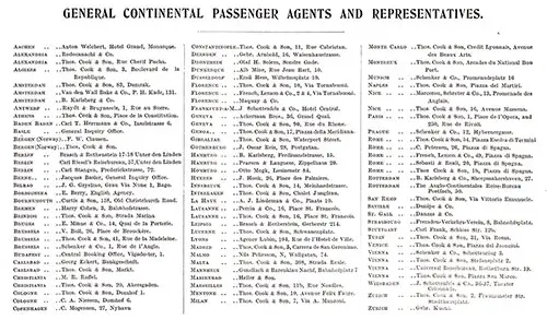
Cunard Line General Continental Passenger Agents and Representatives, 1905. GGA Image ID # 1fbf9dd785
Photographs from the Book
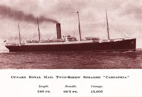
Cunard Royal Mail Twin-Screw Steamer "Carpathia." Length: 540 FT. Breadth: 64.5 FT. Tonnage: 13,603. Cunard Line Handbook, 1905. GGA Image ID # 1fbd41306b
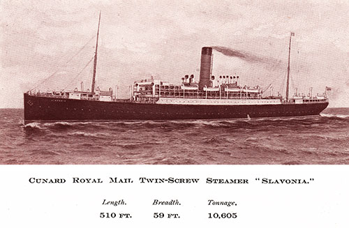
Cunard Royal Mail Twin-Screw Steamer "Slovonia." Length: 510 FT, Breadth: 59 FT. Tonnage: 10,605. Cunard Line Handbook, 1905. GGA Image ID # 1fbd5fb1fb
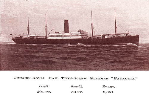
Cunard Royal Mail Twin-Screw Steamer "Pannonia." Length: 501 FT. Breadth: 59 FT. Tonnage: 9,851. Cunard Line Handbook, 1905. GGA Image ID # 1fbd800a10
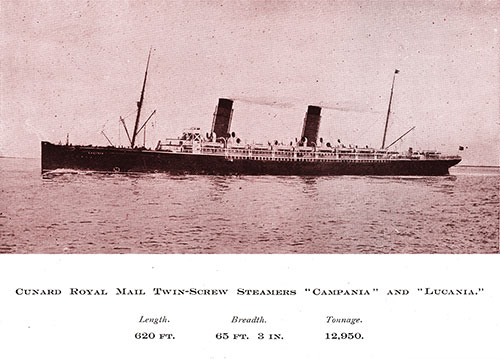
Cunard Royal Mail Twin-Screw Steamers "Campania" and "Lucania." Length: 620 FT. Breadth: 65 FT 3 IN. Tonnage: 12,050. Cunard Line Handbook, 1905. GGA Image ID # 1fbdcf027c
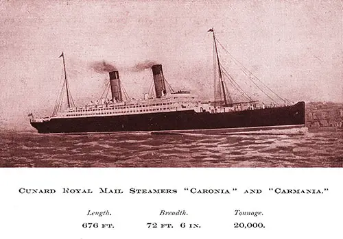
RMS Caronia and RMS Carmania of the Cunard Line. Length: 670 FT. Breadth: 72 FT 6 IN. Tonnage: 20,000. Cunard Line Handbook, 1905. GGA Image ID # 1fbf087c90
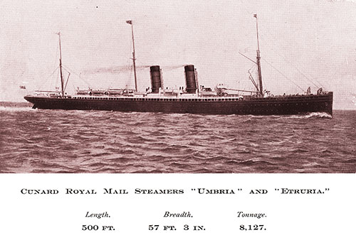
RMS Umbria and RMS Etruria of the Cunard Line. Length: 500 FT. Breadth: 57 FT 3 IN. Tonnage: 8,127. Cunard Line Handbook, 1905. GGA Image ID # 1fbf5d8247
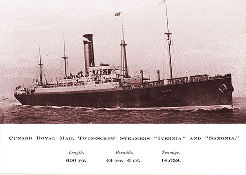
RMS Ivernia and RMS Saxonia of the Cunard Line. Length: 600 FT. Breadth: 64 FT 6 IN. Tonnage: 14,058. Cunard Line Handbook, 1905. GGA Image ID # 1fbf6faf2a
Maps Included in the Cunard Line Handbook

Track Chart and Map Showing Overland Rail Connection to Liverpool from Mediterranean Ports. Cunard Line Handbook, 1905. GGA Image ID # 1fc315021e
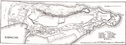
Map of Gibraltar. Cunard Line Handbook, 1905. GGA Image ID # 1fbfa84140
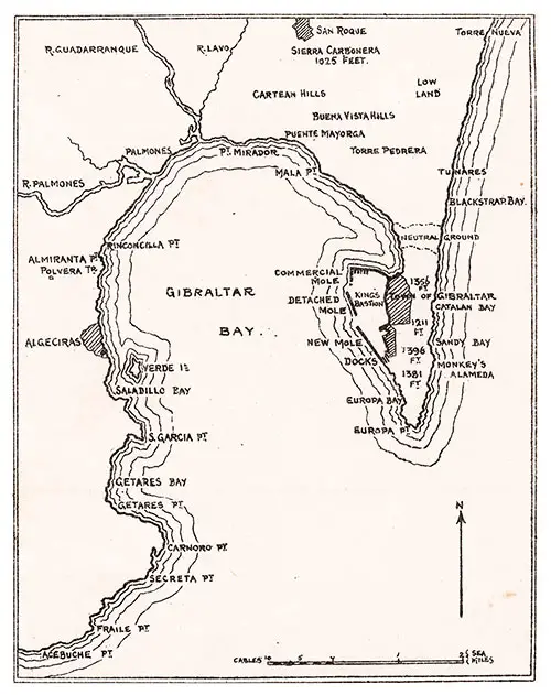
Map of Gibraltar Bay. Cunard Line Handbook, 1905. GGA Image ID # 1fc003fbdb
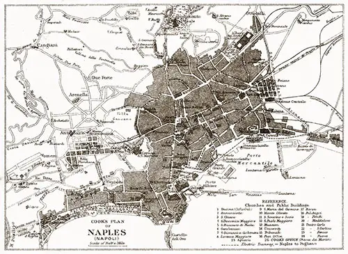
Cook's Plan of Naples (Napoli). Cunard Line Handbook, 1905. GGA Image ID # 1fc0778d70
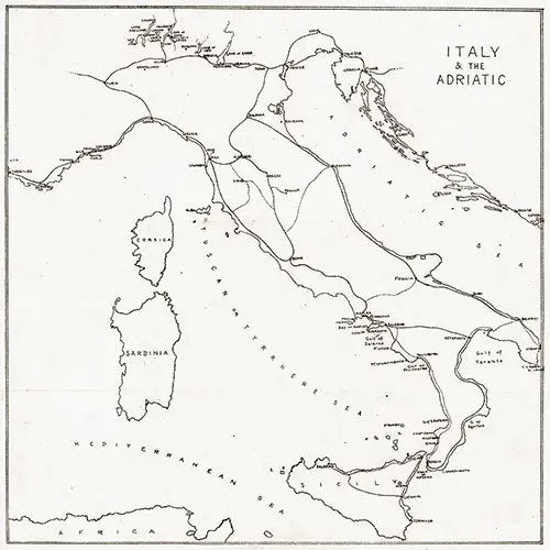
Map of Italy and the Adriatic. Cunard Line Handbook, 1905. GGA Image ID # 1fc0f11949
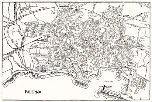
Map of Palermo, Italy. Cunard Line Handbook, 1905. GGA Image ID # 1fc12efe62
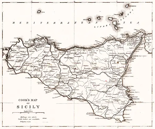
Cook's Map of Sicily. Cunard Line Handbook, 1905. GGA Image ID # 1fc15021b9
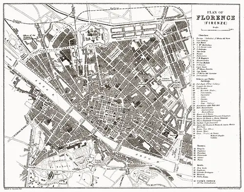
Plan of Florence (Firenze), Italy. Cunard Line Handbook, 1905. GGA Image ID # 1fc157110f
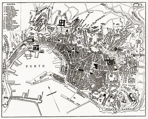
Map of the Port and Harbor of Genoa, Italy. Cunard Line Handbook, 1905. GGA Image ID # 1fc20fbd9b
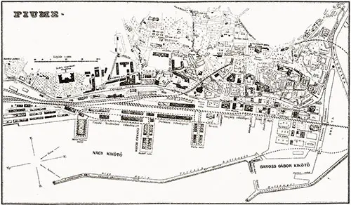
Map of Fiume. Cunard Line Handbook, 1905. GGA Image ID # 1fc2ac69dd
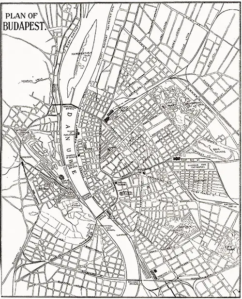
Plan of Budapest, Hungary. Cunard Line Handbook, 1905. GGA Image ID # 1fc2b04a43
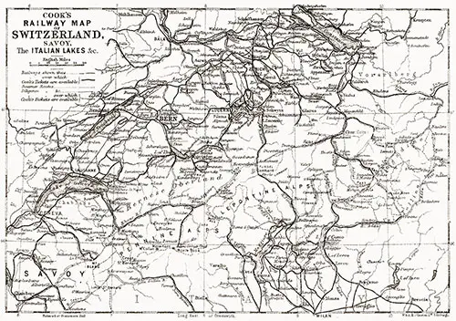
Cook's Railway Map of Switzerland, Savoy, The Italian Lakes, etc. Cunard Line Handbook, 1905. GGA Image ID # 1fc2cbc28c
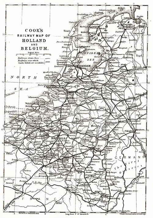
Cook's Railway Map of Holland and Belgium. Cunard Line Handbook, 1905. GGA Image ID # 1fc30261f8
